 |
|
 |
� |
|
| Major Cities |
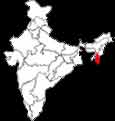
Mizoram, in the local language, means the land of Mizos. Mizo itself means highlander. Under the British administration, Mizoram was known as Lushai Hills district. In 1954 by an Act of Parliament, the name was changed to Mizo Hills district. In 1972, when it was made into a union territory, it was named Mizoram. Mizoram became the 23rd state of the Indian union on February 20,1987. Mizoram is situated between 21-58o to 24o 29' north latitude and 92o 29' to 93o 22' east longitude. The tropic of Cancer passes near the capital, Aizawl town. Mizoram occupies the north east corner of India. In shape it is rather like a narrow and inverted triangle. It is bounded on the north by the district of Cachar (Assam) and the state of Manipur, on the east and south by Chin Hills and Arakan (Myanmar) on the west by the Chittagong hill tracts of Bangladesh and the state of Tripura. Mizoram borders three states of India - Assam , Manipur and Tripura. Its geographical borders with Assam, Manipur and Tripura extended over 123 km, 95 km and 66 km, respectively. Mizoram is a land of hills. The hills run in ridges from north to south. They have an average height of 900 metres, the highest point being the Blue Mountain (2165 metres). TOURISMLAKESThe state has a number of beautiful lakes situated in different parts of its territory Palak Lak It is situated in an almost inaccessible area in the southern part of the state. It is in the Lakher region of Chhimtuipui district, 130 km south-west of Saiha, the district headquarters and 5 km from Pahu village. It is an oval lake, 200 m long and 150 m wide, occupying an area of 30 hectares. The lake is surrounded by tropical evergreen and moist deciduous forests comprising of species like Dipterocarpus sp., Michelia sp., Schina Wallichin, Mesua ferrea, Chikrassia tabularies, cedrella tonna, Albizzia sp., Termemalia sp., Lagerstromia sp., Biscofia Javamica, Ficus sp., Artocarpus sp., Tetrameles nudiflore, bamboos, canes etc. There are fish and crab in the lake. Bear, tiger, deer, wild pig, and variety of avifauna are found in the surrounding forests. In Mizoram, this is the only abode of aquatic birds, with the wild duck of different species. Tamdil Tamdil is situated in Aizawal district. It is about 110 km south-east of Aizawal town and 7 km from Saitual village. 'Tam' is a shortened form of the Mizo word 'antam' which means mustard plant and 'dil' means lake. Tamdil means a lake of mustard plants. A folklore associated with the lake says that there was a big mustard plant in the place where the lake is situated now and whenever this plant was cut off, water came out incessantly thereby creating the lake. The lake is surrounded by tropical evergreen and moist deciduous forest with species like Sehenia Wallichii, Chikrassia tabularis, Albizzia sp., Artocarpus sp., Merus sp., bamboos etc. The aquatic fauna consists of fish. There are plenty of prawns in this lake. In surrounding forests bear, deer, wild pig and common avifauna are found. Rungdil It is situated 14 km from Suangpuilawn village in Aizawal district. It has an area of 2.5 hectares. Rungdil means lake of partridge. It acquired this name as at one time it was the habitat of a large number of partridges. Actually, it consists of two lakes, more or less alike, separated by a narrow stretch of land. It is said that if a pumpkin is cut into two halves and one is put in one lake, it will surface in the other lake. The two lakes are believed to have a subterranean connection. The lake is surrounded by tropical evergreen deciduous forests. Its flora and fauna are of the same type as found in and around the other lakes in Mizoram. Rengdil This is a man made lake unlike the other lakes described earlier which are all natural lakes. This lake is situated in Aizawal district , 150 km to the north-west of Aizawal and about 8 km from Zamuang village. AIZAWLThis is the capital of Mizoram. The Assam Rifles Centre, the administrative buildings and Raj Bhavan are situated here. Mizoram State Museum It is at McDonald's hill, in the centre of Aizawl town. The small museum contains the historical relics, ancient costumes and traditional implements. Bara Bazar It is the main shopping centre. This bazar have stalls selling garments and music cassette recording shops run by Mizo. In the main bazar, people in their traditional costumes sell products from farms and homesteads in little wicker baskets. The Weaving Centre is above the Bata Shoe Shop where you can watch the women at their looms weaving traditional shawls. Luangmual Handicrafts centre The ceremonial bamboo hat 'Khumbeu' is made at Luangmual Handicrafts centre, using waterproof wild' Hnahthial' leaves in Luangmual village 7 Km away from the weaving centre. CAVESMilu Puk Milu Puk means cave of skulls. There is a big cave situated near the village Mamte in Lunglei district, about 130 Km from Lunglei town. In this cave a big heap of human skeletons were found. The skeletons appeared to be of people who were taller than the Mizos and might have belonged to some other race inhabiting the area before the Mizos came. The Legend is that these people belonged to a tribe called 'Tlau". Pukzing Cave Pukzing cave, which goes 25m inside is the biggest cave in Mizoram. It is situated at Pukzing village near Marpara in the western hills within Aizawal district. The legend goes that the cave was carved out of the hills by a very strong man called Mualzavata, the name meaning a person who could clear hundred ranges of forest in one day. Lamsial Puk The cave Lamsial Puk is situated near the village Farkawn in the south-east side of Aizawl district. This cave carries gruesome evidence of a fight between two neighbouring villages in which many warriors were killed. The bodies of the warriors of the Lamsial village were kept in this cave. The village is no longer there. But there are many skeletons in the Lamsial puk which recall this gory incident. Kungawrhi Puk It is a big cave situated on a hill between Farkawn and Vaphai villages in the South-east part of Aizawl district. The folktale associated with this cave speaks of a beautiful young girl named Kungawrhi, after whom this cave was named. She got married to a brave young man, named Pnathira. When the couple was going to Pnathira's village after the marriage, some spirits, bewitched by her beauty, abducted her. The spirits brought her to this cave and kept her confined in it. She was later rescued from the cave by her brave husband. Eastern Villages Some of the eastern villages of Aizawl district are associated with stories of a great war between the Lushais and the pawis. Lungvandawt Lungvandawt means a stone reaching heaven. A very tall beautiful chiselled pillar made of stone about 75cm in diameter and 3m in height is found between Biate and Lungdar in the eastern part of Aizawl district. The story goes that in ancient times this stone pillar was very tall, almost touching heaven and hence nothing could go in between. Once a peacock squeezed into it and got crumbled into pieces. It appears that this probably was a very tall memorial stone of a chief of the Biate tribe who was resident of the area before the Lushais came and defeated the Biates who mostly went down to the plains of Cachar to settle there. Khawnglung Run Khawnglung village, situated in Lunglei, district near its border with Aizawl district was crucial in the famous north-south war of Mizoram Buddha's Image near Mualchang village An engraved image of Lord Buddha has been found about 8 Km away from Mualchang village and 50 Km from Lunglei town. On either side of the Lord's image there are images of dancing girls. On another slab of stone there are engravings of foot marks and various articles like spear head and dao. It appears that these engravings were done by metal chisels as there are marks in nearby stones which indicate the sharpening of metal implements. Thangliana Lung At Demagiri there is a memorial stone erected in memory of captain T.H.Lewin who was the first Britisher to enter Mizoram. He was DC of Chittagong Hill tracts and entered Mizoram through Demagiri in 1865. He was very friendly with all the tribesmen and they honoured him by giving him the Mizo name of Thangliana which means 'greatly famous'. His memorial stone at Demagiri shows how the Mizos held him in great esteem. Suangpuilawn Inscriptions At Suangpuilawn village in Aizawl district there is a stone with inscriptions which have not been deciphered as yet. The stone slab of the size of 1m length and 1m width is placed by the side of the stream. Thansiama Sena Neihna This literally means, a place where a man called Thansiama saw the calf of a mithun. There is a barren hill top, about 2000 meters high, near Chawnglui village in Aizawl district, near Burma border. The top of the hill has a beautiful flat land but it is almost inaccessible because of the steep hill. A folklore says that Thansiama, who lived very long and became a very old man, was once searching for his missing mithun. He saw a calf at this hill top. The missing mithun had climbed up the hill, an impossible task and given birth to the calf at this place. This is a story of hallucinations of old and lonely men.
Mizoram has a number of places which are of historical interest and are associated with folklore, legends and stories which are passed on from generation to generation. Phawngpui The Blue Mountain, which is the highest mountain peak in Mizoram, 2165m in height, is known as Phawngpui to the people of Mizoram. It is situated close to the Burma border, on the curve of the river Kolodyne, in the Chhimtuipui district. It is famous for Orchids and rhododendrons. The nearest village is Sangau. This is a very sacred peak, considered to be the abode of the Gods. Once a year, ritual sacrifices are offered here. Commanding a majestic view over the hills and the valleys, this peak presents the most enchanting scenic beauty in Mizoram. There is a semi-circular beautiful cliff in the western side called Thlazuang Khamm which has a sharp and deep fall. This is the habitat of the wild mountain goats. This cliff was believed to be haunted by spirits. On the peak, there is a level ground about 200 hectares in area. This place is surrounded by matted bamboo groves and other beautiful flora. Varieties of butterflies, including some rare species, are found here. On the east one can see a deep green forest. On the other side at a great distance, villages are silhouetted in a big canvas of wavy hills. Sibuta Lung This is a memorial stone found at Tachhip village, 20 Km from Aizawl town. It was erected by a Palian chief about 300 years ago. A young orphan, Sibuta, was adopted by the chief. He killed his adoptive father and became the chief of over 2,000 houses. But he failed in his love life and was jilted by a girl. For having his revenge he put a young and beautiful girl, Darlai, in a big pit on which he wanted to erect a memorial for himself. The huge rock was dragged with great pains from the bed of the Tlawng river, 10 Km away. The stone was bathed with the blood of three human beings who were sacrificed. The stone was erected putting Darlai alive on the pit below the stone. Phulpui Grave There are two graves at Phulpui village in Aizawl district. Zawlpala, Chief of Phulpui village, married the legendary beauty, Talvungi of Thenzawl. She was subsequently married to the chief of Rothai, Punthia. But she could not forget Zawlpala. After many years when Zawlpala died, grief stricken Talvungi came to Phulpui, dug a pit by the side of Zawlpala's grave and induced an old woman to kill her and bury her in the grave. The love story, the graves and other associated places at Phulpui are attractions to visitors. Memorial of Chhingpui There is a memorial stone for a beautiful young woman called Chhingpui in a place between Baktawng and Chhingchhip village on the Aizawl-Lunglei road. Chhingpui came from a noble family and was extraordinarily beautiful. From among the many young men wanting to marry her. She chose Kaptuanga and married him. They were very happy. But bad days came upon them when war broke out between the rival chiefs. Chhingpui was kidnapped and killed. For days all the villagers mourned her death. Kaptuanga could not bear the loss and killed himself. Chhingpui's memorial has kept the love story alive among the people. Pangzawl Pangzawl village of Lunglei district is associated with the tragic folklore of Chawngungi. She was a very beautiful girl sought for, by all young men. But her mother demanded a very high bride price which could not be afforded by anyone. Ultimately, the Chief's son, Sawngkhara, won her by using a magic drug. However, she died soon after the marriage. Sawngkhara lived the rest of his life mourning the death of his beautiful, young wife. Mangkahia Lung At Champhai in Aizawl district, near the Burma border, there is a very large memorial stone called Mangkahia Lung( Mangkhaia's stone). It is 5m high with heads of mithun engraved on it. This was erected around AD 1700 in memory of Mangkhaia who was a very prominent chief of the Ralte tribe. Tomb of Vanhimailian Vanhimailian Sailo was a great chief who ruled over Champhai. A tomb was erected in his memory overlooking the vast Champhai plain. Tualchang Near Tualchang village in the eastern part of Aizawl district, there is a row of stone slabs. The largest of the rocks is 3m wide 1m thick and 4.5m high. It is the biggest monolith in the state. |
|